What is a river?
A river is a moving body of water that drains the land.
It flows from its source on high ground, across land, and then into another body of water. This could be a lake, the sea, an ocean or even another river.
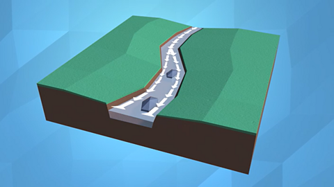
A river flows along a channel with banks on both sides and a bed at the bottom.
If there is lots of rainfall, or snow or ice melting, rivers sometimes rise over the top of their banks and begin to flow onto the floodplains at either side.
How are rivers formed?
Rivers usually begin in upland areas, when rain falls on high ground and begins to flow downhill. They always flow downhill because of gravity.
They then flow and bend (meander) as they cross the land or go around objects such as hills or large rocks. They flow until they reach another body of water.
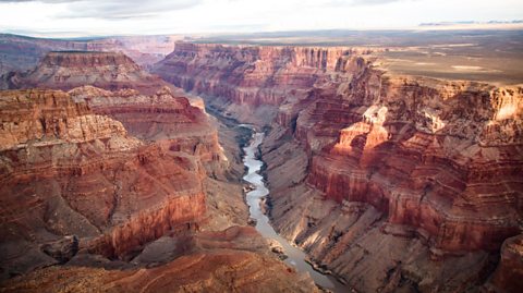
As rivers flow, they erode (or wear away) the land.
Over a long period of time rivers create valleys, or gorges and canyons if the river is strong enough to erode rock. They take the sediment (bits of soil and rock) and carry it along with them.
Small rivers are usually known as streams, brooks or creeks. If they flow from underground they are called springs.
Watch: Rivers
I’m in Sweden, following the route of a river that flows across the country, and out to the sea.
I’m starting from the beginning of the river which we call the source, here in the mountains.
Rivers often start in upland areas like this, from lakes, marshes and glaciers or even springs that bubble out of the ground.
A river has a channel with banks on both sides and a bed.
Around the main channel of the river is the flood plain where the river expands when it floods.
Rivers always flow downhill because of gravity, going where there is the least resistance, so they meander or move around obstacles like large rocks and hills.
Over time, they erode or wear away soil and rock to create canyons and gorges!
My kayak is being pushed along by the water as it gradually flows downhill.
The water looks quite flat here, but in other places it can be much steeper, like waterfalls!
Rivers like the Amazon and Nile are nearly 7,000 kilometres long and can be several kilometres wide in some places.
Some rivers flow into lakes or other larger rivers.
Finally, I’ve reached the mouth of the river, which in this case flows out to the sea.
I think I’m going to need a bigger boat!
Why are rivers important?
Rivers provide:
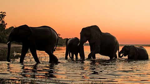
- habitats for wildlife
- freshwater for settlements, agriculture, and other industries
- resources for leisure and tourism
- navigation for exploration, trade and commerce
- a means to transport nutrients and sediment
- changing levels of energy that shape the landscape
- energy for hydro-electric power
Rivers and the water cycle
- Rivers are an important part of the water cycle and responsible for transferring water to oceans.
- Human activity is a main cause of pollution in rivers and oceans, and of some increased flooding events.
- Flooding and drought can have catastrophic impacts on wildlife and people.
- Careful environmental management can reduce flooding and pollution.
River pollution
Environmental charities say that rivers in the UK are being polluted by farm waste, abandoned mines and household sewage (things people flush down the toilet).
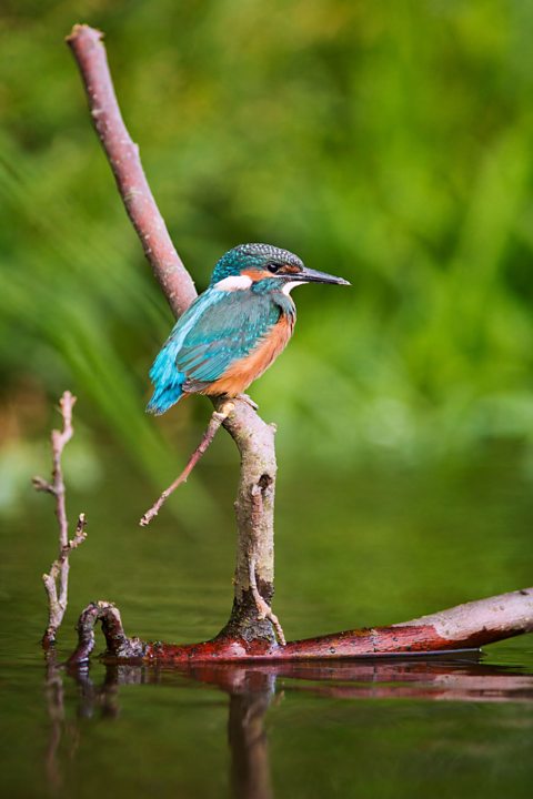
Animals such as kingfishers, dragonflies and otters rely on clean water to survive, so river pollution is a threat to wildlife.
People visit lakes and rivers to see and enjoy the wildlife living there. There are economic benefits as well as environmental ones for having healthy rivers.
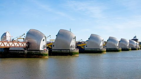
River management
The Thames Barrier is an important defence against flooding for the capital city of London.
The impact of climate change means tidal flood risk will increase over time, unless this risk is carefully managed.
Watch: Rivers in the UK
Learn more about the features and risks of rivers in this video from BBC Teach.
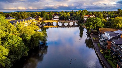
De-Graft: There are hundreds of rivers and streams all across England, Scotland, Northern Ireland and Wales. This is the River Severn, the longest river in the UK.
I’m in a place called Ironbridge where the River Severn runs through. And later locals Riley and Maisie will be joining me on the riverbank to explore. But first, let’s zoom out.
I’m on the River Severn at this point here on the map… But the river actually starts up in the Cambrian Mountains of mid-Wales here, and runs all the way into the Bristol Channel down here. The second longest river in the UK after the River Severn is the Thames, which stretches right across here and all the way through London.
When you look at rivers like the River Severn or the Thames, you can see how there are major towns and cities along the route of the river. This is because historically people built settlements near rivers for easy access to fresh water for homes and for farming. And also because rivers have acted as easy transport routes for boats to move people and goods from place to place. But how do rivers like this begin?
Every river has a starting point called a ‘source’, most are on mountains because that is where rain often falls. Water collects and starts to flow down as a stream. Several of these small streams join together to form a river. At this stage the water is fast flowing and can create rapids, waterfalls, gorges and valleys.
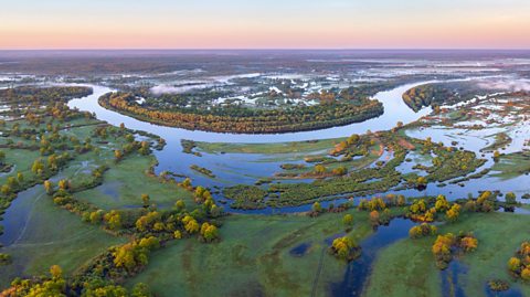
The middle part of a river is on lower ground. Some streams and smaller rivers feed into it and they are called tributaries. The river carves its own path out to the sea and creates bends called ‘meanders’. Sometimes a river becomes so bendy it creates an easier route straight across and cuts off the meander. This forms what is called an ox-bow lake.
As all rivers continue they become deeper and wider. The majority of rivers then eventually join the sea at what is called it’s mouth, often forming an estuary.
Ryley and Maisie are joining me on the bank, or the side of the river. They’re studying the river by taking photos of all the different things they can spot.
Can you see that tree that's got like that?
Children: Looks a bit like an arch.
De-Graft: Yeah, like an arch! What has been the most interesting thing you two have taken a picture of today?
Maisie: Really small ripples in the river and because of the Sun, it's been reflecting onto it and making it all gold.
Riley: I saw some little, tiny fish. They were swimming really fast.
De-Graft: Well historically, people used rivers to transport goods and bring trade to different areas. So, what kind of things do you think were transported on this river in the past?
Riley: Vegetables and firewood.
Maisie: I think coal and flour to make bread and dough.
De-Graft: You’re absolutely right. Hundreds of years ago, the River Severn was actually the second busiest river in the whole of Europe.
Ryley: Woah, that’s cool.
De-Graft: That is cool. When we talk about rivers, one word that comes up is ‘flooding’. Do either of you two know what it means?
Ryley: It's when water overflows and it goes onto land.
De-Graft: Yeah, when a river gets too full, usually because of heavy rainfall, it can overflow or it can flood. Now, the land around a river that floods is called a floodplain.
OK, time to compare… The River Severn is over 354 kilometres long making it the longest river in the UK, but the longest river in the world is the Nile in north-eastern Africa, at a whopping 6,650 kilometres! The Amazon river is the second longest in the world but the largest by the amount of water it carries.
As well as the Amazon and the Nile, there are many rivers around the world measuring over 1,000 kilometres long. Why not try and find out about one yourself – what does it look like? Where does it start? Where does it end? Zoom in and have a look for yourself.
Right guys, time for one last photo.
Activity: Quiz – Rivers
SATs preparation resources. activity
Get ready for the SATs papers with videos, activities, quizzes and games to refresh your knowledge and practise your skills.

More on The natural world
Find out more by working through a topic
- count8 of 16
- count10 of 16
- count11 of 16